
There will be two levels of difficulty, the Lighthouse Race, which is designed for those with an average level of fitness, and the Sails & Summits Race, designed for those with more advanced fitness. Both races are made more challenging by the elevations being traversed. We have chosen an area of outstanding natural beauty of serene lakesides, steep inclines, and the rugged terrain of the Swiss landscape.
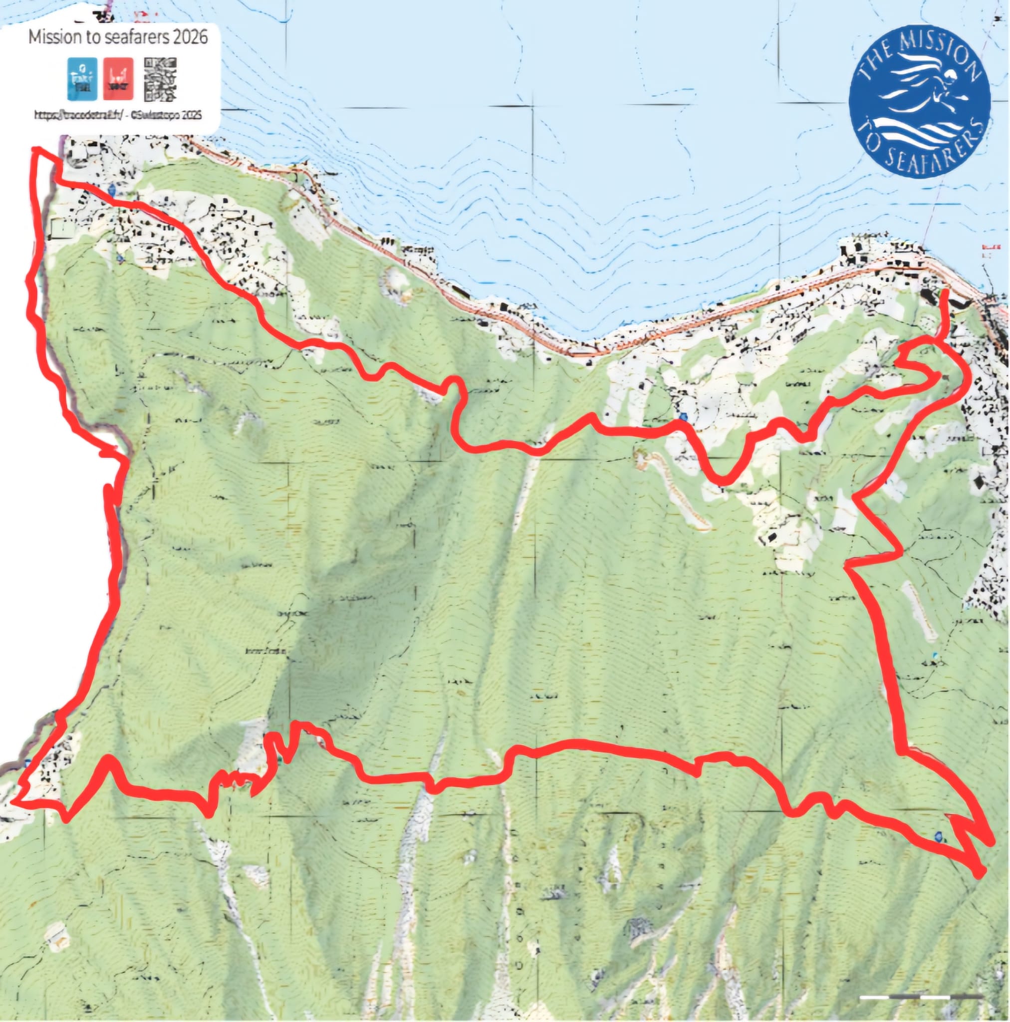
For racers tackling Le Bouveret’s trails, the journey is an exhilarating blend of natural obstacles, from the rivers that carve through the terrain, to sharp ascents that promise to push your boundaries.
The Sails & Summits Race requires a high level of fitness, offering stretches that climb aggressively. The Lighthouse Race is shorter, with steep inclines, sufficient to test you, but suitable for those who have an average level of fitness. Both trails will have you journey through the forest, revealing breath-taking panoramic views at every peak. This setting is far removed from a leisurely lakeside stroll; it’s an adventure meant to engage you in a test of stamina, speed, and agility.
The focal point here is not just the physical endurance required but also the reward of unparalleled views of the Alps and the vast expanse of Lake Geneva, presenting a dynamic backdrop that changes with every elevation gained.
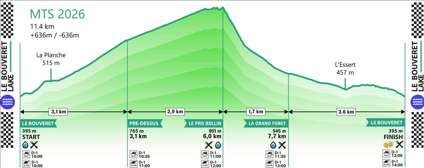
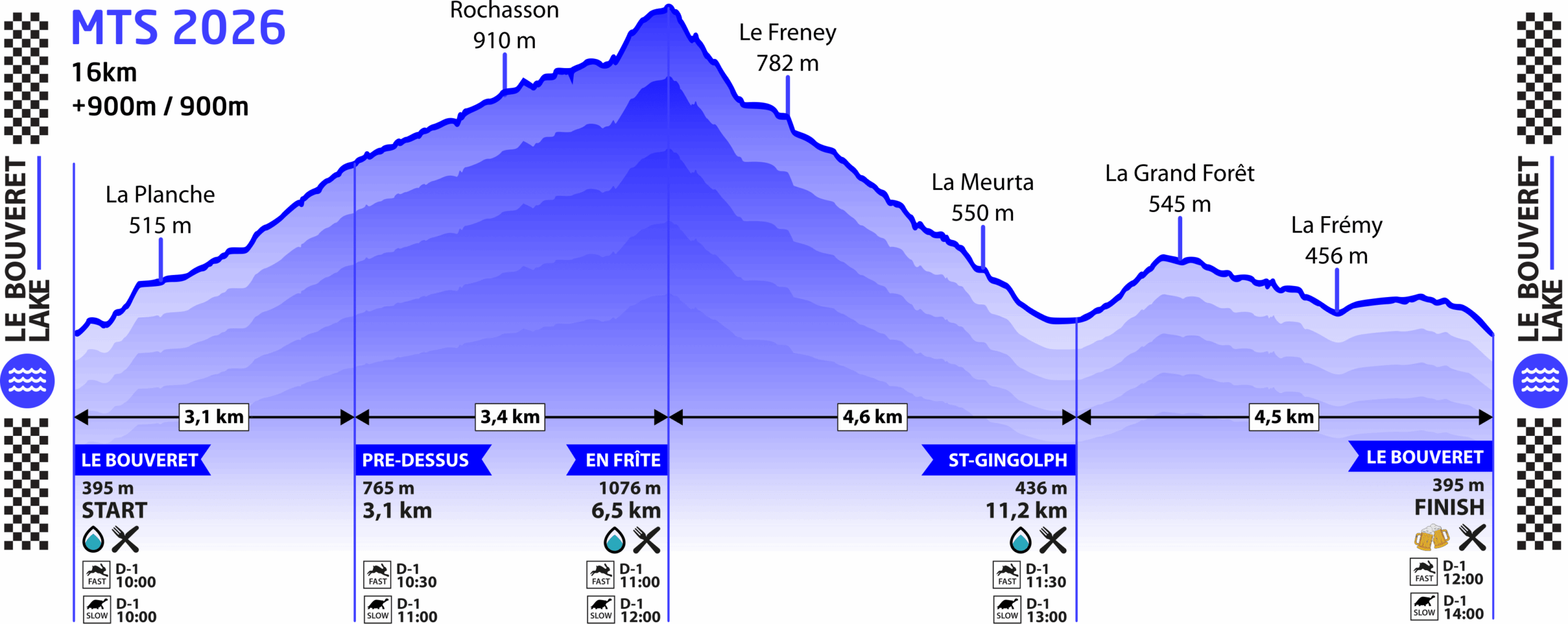
Both race courses and elevation profiles are below.
Lighthouse Race

Elevation Profile:
Sails & Summits Race
Elevation Profile: